Images/Databases
Global Human Settlement — open data on “human settlement presence”
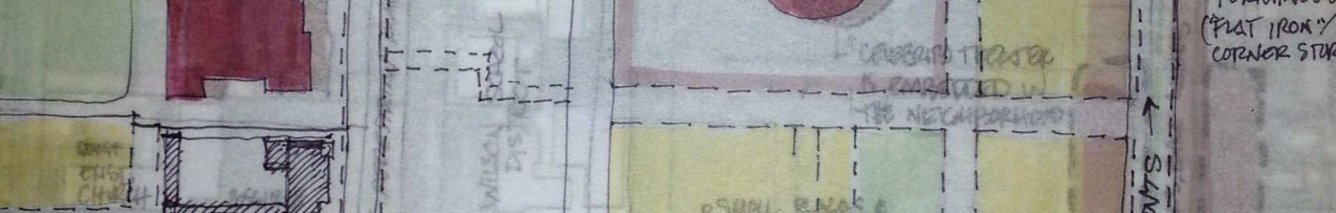
Digitized Historic Maps of Chicago by Cris Sakamoto
Renewing Inequality — tracks family displacement during urban renewal
Vacant New York — a project to map vacant storefronts
The Bastides Collection — compiled by John Reps
Population mountains — cool visualization of city population
Every building in the Netherlands, by age — all 10 million of them
Aerial images of rich vs. poor
Mexico City’s multicolored markets
Map of Inclusionary Housing in the U.S.
What does 80,000 people look like?
Density of traditional urbanism
Strong Towns on the damage of parking minimums
New York City plans and what became of them
Gentrification and displacement in the Bay Area
Chicago building activity by neighborhood
The storefront index maps street-facing businesses
Explore the Urban Layers of Manhattan
Built : LA – Building Ages in Los Angeles
Mapping Decline: St. Louis and the American City
Simulation of the World’s Columbian Exposition of 1893
Alex MacLean’s aerial photographs
Transect Collection: photographs of natural & built environments
The Codes Project (depository of urban codes)
What Makes Paris Look Like Paris?
The Built Environment, Traffic Safety and Travel Choice